|
If you are unable to see the blue navigation
buttons below, go to Contents for text links.


| |
 |
|
Holling C Holling Books
Horrible Geography

 Minn of the Mississippi
- Follow the adventures of Minn, a snapping
turtle, as she travels hundreds of miles from the source of the Mississippi to the Gulf of
Mexico. Her adventure illustrates the life cycle of the turle and the geography,
history, geology, and climate of the river. Also learn about bayous, keel boats and more. Minn of the Mississippi
- Follow the adventures of Minn, a snapping
turtle, as she travels hundreds of miles from the source of the Mississippi to the Gulf of
Mexico. Her adventure illustrates the life cycle of the turle and the geography,
history, geology, and climate of the river. Also learn about bayous, keel boats and more.
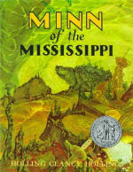
The adventures of a three-legged snapping turtle as she travels from the
headwaters to the mouth of the Mississippi River illustrate the life cycle of
the turtle and the geography, history, geology, and climate of the river.
Paper, 87 pages.
#3994 $11.95 $10.99


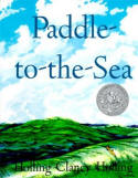 Paddle-to-the-Sea written and illustrated by Holling Clancy Holling. A
Caldecott honor book written in 1941, the story follows the adventures of a
small canoe with a tiny figure inside. Carved by an Indian boy in Canada and
named Paddle-to-the-Sea, the canoe is released above the Great Lakes, and the
reader follows the canoe throughout its travels to a sawmill, through the Great
Lakes, over Niagara Falls, down the St. Lawrence River and all the way to the
Atlantic Ocean. The writing and artwork is incredibly detailed. It is fun to
read and provides an enjoyable way to learn the geographic and historical
information of the region. Paddle-to-the-Sea written and illustrated by Holling Clancy Holling. A
Caldecott honor book written in 1941, the story follows the adventures of a
small canoe with a tiny figure inside. Carved by an Indian boy in Canada and
named Paddle-to-the-Sea, the canoe is released above the Great Lakes, and the
reader follows the canoe throughout its travels to a sawmill, through the Great
Lakes, over Niagara Falls, down the St. Lawrence River and all the way to the
Atlantic Ocean. The writing and artwork is incredibly detailed. It is fun to
read and provides an enjoyable way to learn the geographic and historical
information of the region.
Paddle-to-the-Sea reminds me of my childhood fascination with putting
leaves and other floating objects in the gutter in front of my house after a
rainstorm, or in the creek near my Dad's childhood home. I would watch each leaf
as it floated and swirled, sometimes getting stuck and then breaking free. If it
started to go out of visual range, I would run after it until I couldn't see it
anymore. I sometimes still visualize a leaf floating down a stream when trying
to go to sleep. Amazing how childhood memories can stick with you!
This is one of our family's all-time favorite books.
Paper, 62 pages.
#2034 $11.95 $10.99
Damaged Paddle to the Sea book - The cover has a crease. The rest of the book is
in excellent condition.
#D-2034 $11.95 $7.99
******
Paddle-to-the-Sea is also available on CD. Wonderfully read by
Terry Bregy. Unabridged running time: 60 minutes on 1 CD. While this item is
currently out of stock with the publisher (it is being reprinted), we have a
small supply in stock.CD: #114X $16.95 $11.99
Sale Price!
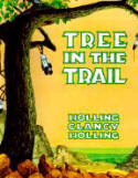 Tree in the Trail - Over a period of 200 years a cottonwood tree
witnesses what happens on the Santa Fe Trail. Readers will become acquainted with the
story of the earliest Indians, Spanish conquistadores, buffalo stampedes, wagons moving
west and more. Tree in the Trail - Over a period of 200 years a cottonwood tree
witnesses what happens on the Santa Fe Trail. Readers will become acquainted with the
story of the earliest Indians, Spanish conquistadores, buffalo stampedes, wagons moving
west and more.
Paper, 64 pages.
#534X $11.95 $10.99
 A Literature Approach to Geography, History and Science Using the Holling
Clancy Holling Books by Rea C. Berg. A 14-page guide to use in conjunction with
the above four Holling classics. Intended as a year-long study to cover geography,
history, science and more (we'd use it as a reference). It's also designed to be used with
the four maps available below. A Literature Approach to Geography, History and Science Using the Holling
Clancy Holling Books by Rea C. Berg. A 14-page guide to use in conjunction with
the above four Holling classics. Intended as a year-long study to cover geography,
history, science and more (we'd use it as a reference). It's also designed to be used with
the four maps available below.
Three main geographic regions of North America are covered
as well as an introduction to world geography in the book, Seabird. The North American
regions covered include the Great Lakes, St Lawrence River & North Atlantic
(Paddle-to-the-Sea); the Great Plains & Southwest (Tree in the Trail); and the
Mississippi River & Gulf of Mexico (Minn of the Mississippi). Includes Christian
references.
Ages 7-12. Paper.
#BF01 $9.95
 Africa Counts: Number and Pattern in African Cultures, 3rd edition
- by Claudia Zaslavsky. This fascinating study of mathematical thinking among
sub-Saharan African peoples covers counting in words and in gestures; measuring
time, distance, weight, and other quantities; manipulating money and keeping
accounts; number systems; patterns in music, poetry, art, and architecture; and
number magic and taboos. African games such as mankala and elaborate versions of
tic-tac-toe show how complex this thinking can be. This third edition is updated
with an introduction covering two decades of new research in the
ethnomathematics of Africa. Africa Counts: Number and Pattern in African Cultures, 3rd edition
- by Claudia Zaslavsky. This fascinating study of mathematical thinking among
sub-Saharan African peoples covers counting in words and in gestures; measuring
time, distance, weight, and other quantities; manipulating money and keeping
accounts; number systems; patterns in music, poetry, art, and architecture; and
number magic and taboos. African games such as mankala and elaborate versions of
tic-tac-toe show how complex this thinking can be. This third edition is updated
with an introduction covering two decades of new research in the
ethnomathematics of Africa.
Claudia Zaslavsky was a mathematics teacher and the author of
Math Games and Activities from Around the World,
More Math Games and Activities from Around the World and other books.
#3505 $18.95
|
 Fair is Fair:
World Folktales of Justice by Sharon Creeden. This is another book that came
highly recommended to us by one of our customers. We love it! The author is a
trial attorney who has collected 30 stories from different countries and time
periods that illustrate various aspects of law. Each story is followed by
sources for further reading and also comments that will sometimes relate the
story to our current legal system, items of historical interest, a discussion of
a legal principle within the story, and more. It is especially good as a family
or group read-aloud (we read these to our children on a long car trip) as it
sparks interesting discussions. Fair is Fair:
World Folktales of Justice by Sharon Creeden. This is another book that came
highly recommended to us by one of our customers. We love it! The author is a
trial attorney who has collected 30 stories from different countries and time
periods that illustrate various aspects of law. Each story is followed by
sources for further reading and also comments that will sometimes relate the
story to our current legal system, items of historical interest, a discussion of
a legal principle within the story, and more. It is especially good as a family
or group read-aloud (we read these to our children on a long car trip) as it
sparks interesting discussions.
These are timeless tales that impart ideas of character and justice all on
their own and can be a springboard to further discussions about justice,
culture, folktales, forgiveness and other topics. The additional information
will provoke deeper study of the principles told . Appropriate for a wide age
range (younger kids: read aloud, teens & adults can read independently, but try
to read it aloud). There are a couple of stories that may be more appropriate
for teens, especially in the fourth section of the book that covers the crime of
murder, so you may want to give them a quick preview. Paper, 223 pages
#4775 $12.95
A few of the tales:
The Stolen Smells (United States)
The Warmth of a Fire (Jewish)
The Quality of Mercy (Morocco)
The Pear Seed (China)
Judge Coyote (Mexico)
Whose Children? (Africa)
The Lawyer's Advice (Denmark)
The Thief Who Slid Down a Moon Beam (Turkey)
The Furies (Ancient Greece)
Tip: Pair this with Tales from Cultures Far
and Near by Jim Weiss - in our Storytelling
section
|
 The
Geography Coloring Book, 3rd edition by Wynn Kapit - Learn geography as you
color around the world! All 50 U.S. states are included in this book, as well as
the nations of the world. Physical, thematic (climate, rainfall major religions,
etc) and political maps are all included. There are also historical maps to show
the movement of the continents, the transformation of the Soviet Union into
fifteen separate nations, comparisons of eight historic empires to modern-day
maps with extensive information on the rise and fall of each. The
Geography Coloring Book, 3rd edition by Wynn Kapit - Learn geography as you
color around the world! All 50 U.S. states are included in this book, as well as
the nations of the world. Physical, thematic (climate, rainfall major religions,
etc) and political maps are all included. There are also historical maps to show
the movement of the continents, the transformation of the Soviet Union into
fifteen separate nations, comparisons of eight historic empires to modern-day
maps with extensive information on the rise and fall of each.
This is definitely
not your typical coloring book! A set of fine-pointed felt-tip pens or colored
pencils are recommended for coloring but you can also use this as a great
reference atlas without coloring. Includes lots of information with an extensive
Index/Dictionary that can also be used to as a challenging quiz.
Third edition.
Paper, 200 pages. Older children-adults.
#4722 $26.40 $21.99
|
 Geography
for Dummies
by Charles A. Heatwole, Ph.D.
- Whether you're sixteen or sixty, this fun and easy guide will help you make
more sense of the world you live in. Geography For Dummies gives you
the tools to interpret the Earth's grid, read and interpret maps, and to
appreciate the importance and implications of geographical features such as
volcanoes and fault lines. Plus, you'll see how erosion and weathering have and
will change the earth's surface and how it impacts people. You'll get a firm
hold of everything from the physical features of the world to political
divisions, population, culture, and economics. You'll also discover: * How you
can have a rainforest on one side of a mountain range and a desert on the other
* How ocean currents help to determine the geography of climates * How to choose
a good location for a shopping mall * How you can properly put the plant to good
use in everything you do * How climate affects humans and how humans have
affected the climate * How human population has spread and the impact it has had
on our world. Geography
for Dummies
by Charles A. Heatwole, Ph.D.
- Whether you're sixteen or sixty, this fun and easy guide will help you make
more sense of the world you live in. Geography For Dummies gives you
the tools to interpret the Earth's grid, read and interpret maps, and to
appreciate the importance and implications of geographical features such as
volcanoes and fault lines. Plus, you'll see how erosion and weathering have and
will change the earth's surface and how it impacts people. You'll get a firm
hold of everything from the physical features of the world to political
divisions, population, culture, and economics. You'll also discover: * How you
can have a rainforest on one side of a mountain range and a desert on the other
* How ocean currents help to determine the geography of climates * How to choose
a good location for a shopping mall * How you can properly put the plant to good
use in everything you do * How climate affects humans and how humans have
affected the climate * How human population has spread and the impact it has had
on our world.
If you're mixed up by map symbols or mystified by Mercator
projections, Geography For Dummies can help you find your bearings.
Filled with easy-to-read maps, and cool facts, this book will expand your
understanding of geography and today's world.
Paper,
382 pages. 9.1"x7.4"x.9"
#6221 $19.99 $15.99
One copy available.
|
Geography from A to Z: A Picture Glossary by Jack Knowlton. Do you know
the difference between a plateau and a plain? Between a knoll and an atoll? Have
you ever wondered what a badland is? Or an isthmus? Or a gulch?
Sixty-three
different geographic features are described in big type, in one or two sentences, and each
is accompanied by a color illustration.
Paper, 48 pages. Ages 4-9.
#0991 $7.99
 Hopscotch Around the World: Nineteen
Ways to Play the Game Learn how children in 16
different countries play hopscotch, a game universally popular for centuries.
Directions and illustrations accompany each version, as well as notes on each
country's influence on the game. This is a really fun way to learn about other
countries and their people. Hopscotch Around the World: Nineteen
Ways to Play the Game Learn how children in 16
different countries play hopscotch, a game universally popular for centuries.
Directions and illustrations accompany each version, as well as notes on each
country's influence on the game. This is a really fun way to learn about other
countries and their people.
Paper, 48 pages. Ages 7 and up.
#7453 $6.99
|
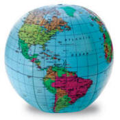
Inflatable
Globe - Make a game of geography. Kids can toss this globe and identify
continents, countries, capitals and oceans, or hang for display.
This 12" inflatable globe includes a repair kit and an activity guide.
#2432 $5.95
|
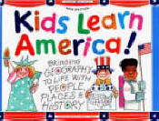 Kids Learn America: Bringing Geography to Life with People, Places &
History (A Kids Can! Book) - States are presented by geographic region,
and each is given two to four pages in the book. Includes trivia, easy
activities & crafts, recipes and more. Kids Learn America: Bringing Geography to Life with People, Places &
History (A Kids Can! Book) - States are presented by geographic region,
and each is given two to four pages in the book. Includes trivia, easy
activities & crafts, recipes and more.
Paper, 176 pages. Ages 7-12.
#3317 $12.95 $11.65
|
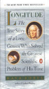 Longitude:
The True Story of a Lone Genius Who Solved the Greatest Scientific Problem of
His Time by Dava Sobel. The active quest for a solution to the problem
of longitude persisted over four centuries and across all of Europe. Lacking the
ability to determine their longitude, sailors were literally lost at sea as soon
as they lost sight of land. Ships ran aground on rocky shores; those traveling
well-known routes were pray for pirates. In 1714 England�s Parliament offered a
huge reward to anyone whose method of measuring longitude could be proven
successful. The scientific establishment had spent centuries confidently mapping
the heavens for a celestial answer. John Harrison, a self-taught Yorkshire
clockmaker, dared to imagine a mechanical solution - a clock that would keep
precise time at sea, something no clock had been able to do on land. Longitude:
The True Story of a Lone Genius Who Solved the Greatest Scientific Problem of
His Time by Dava Sobel. The active quest for a solution to the problem
of longitude persisted over four centuries and across all of Europe. Lacking the
ability to determine their longitude, sailors were literally lost at sea as soon
as they lost sight of land. Ships ran aground on rocky shores; those traveling
well-known routes were pray for pirates. In 1714 England�s Parliament offered a
huge reward to anyone whose method of measuring longitude could be proven
successful. The scientific establishment had spent centuries confidently mapping
the heavens for a celestial answer. John Harrison, a self-taught Yorkshire
clockmaker, dared to imagine a mechanical solution - a clock that would keep
precise time at sea, something no clock had been able to do on land.
This is a beautifully told true story of astronomy, navigation, clockmaking, history,
and geography, mixed with intrigue, greed, and ambition.
For experienced
readers. By the author of Galileo�s Daughter.
Paper, 184 pages. Size: 7.5"x4.5".
#8795 $11.95
|
 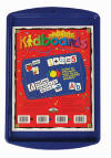  Magnetic
USA Kit (Barker Creek) - Includes Magnetic KidUSA Activity Book, set of
Magnetic KidUSA magnets (includes magnets for all 50 states and their capital
cities - 100 high-quality magnetic pieces), set of Magnetic KidUSA state
abbreviations, set of 52 blank magnets for creating your own words, and a
blue Magnetic Kidboard (a metal tray on which you can put your magnets). Magnetic
USA Kit (Barker Creek) - Includes Magnetic KidUSA Activity Book, set of
Magnetic KidUSA magnets (includes magnets for all 50 states and their capital
cities - 100 high-quality magnetic pieces), set of Magnetic KidUSA state
abbreviations, set of 52 blank magnets for creating your own words, and a
blue Magnetic Kidboard (a metal tray on which you can put your magnets).
The 152-page KidUSA Activity book is packed with activity pages, fascinating
facts, flash cards, maps and more. It is designed to help children memorize
their states and capitals in a fun, hands-on way. It is reproducible for family
and classroom use.
The magnets are used with the activity book or on their own. You can also use
the magnets on the included metal tray. The tray is also great to use with other
magnets you may have (for making words out of individual letter magnets, for
example).
Includes book, 3 sets of magnets and metal tray.
#FUN68 $67.91 $49.99
One set available.
|
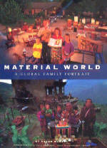
Material World: A Global
Family Portrait by Peter Menzel. Thirty different "statistically average"
families in thirty countries are profiled. Photographers lived for a week with
each family; and at the end of the week, a photo of each family surrounded by
all of their material possessions was taken outside of their homes. Statistical
information accompanies each photo-essay, providing an opportunity to contrast
the different levels of material wealth.
Hardcover.
360 color photos. 255 pages.
#4378 $39.95 $24.99
Sale!
|
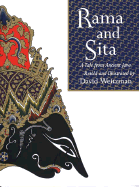 Rama
and Sita: a Tale From Ancient Java retold and
illustrated by David Weitzman - The story of Rama and Sita, taken from
the Hindu epic The Ramayuna, or Rama's Way, has enchanted countless generations
of children. But more than just entertainment, the puppet play is an offering to
the gods and ancestors, teaching the children the values of their community, who
they are, and their place in the universe. Rama
and Sita: a Tale From Ancient Java retold and
illustrated by David Weitzman - The story of Rama and Sita, taken from
the Hindu epic The Ramayuna, or Rama's Way, has enchanted countless generations
of children. But more than just entertainment, the puppet play is an offering to
the gods and ancestors, teaching the children the values of their community, who
they are, and their place in the universe.
David Weitzman's retelling
runs somewhat shorter than the original that runs to some twenty-five thousand
verses but lacks none of its excitement and pageantry. He has chosen Javanese
shadow puppets made by artisans of Jakarta and Yogyakarta as the models fro the
drawings in his elegant retelling of the story of Rama and Sita. The
illustrations are amazing.
The artistry in the illustrations and in
the elegant, airy book design comes close to replicating a primary experience;
no intermediary comes between readers and the
dalang (storyteller) who brings Hindu literature to life. The
epic of Prince Rama unfolds in tightly condensed form as non-stop adventure.
~ Publishers Weekly
Hardcover, 32 pages. Out of print. Rare.
#1519 $39.99
One copy available.
|
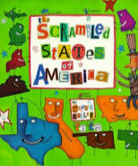 The Scrambled States of America
by Laurie Keller. Filled with humor and silly illustrations, The Scrambled
States of America is a fun way to learn about the 50 states and their
locations. Each state is a character, with its own color, shape, and
personality. One morning, Kansas wakes up bored and unhappy (what a state to be
in!) He and his best friend, Nebraska, decide to organize a party with the other
states so they can meet each and have a good time. At the end of the party,
Idaho and Virginia suggest that everyone switch places. All the states excitedly
agree and soon the map of the U.S. is completely different. After a few days
enjoying themselves, each state finds that they miss their old home. Soon,
everyone is home and sharing their adventures with their old friends. The Scrambled States of America
by Laurie Keller. Filled with humor and silly illustrations, The Scrambled
States of America is a fun way to learn about the 50 states and their
locations. Each state is a character, with its own color, shape, and
personality. One morning, Kansas wakes up bored and unhappy (what a state to be
in!) He and his best friend, Nebraska, decide to organize a party with the other
states so they can meet each and have a good time. At the end of the party,
Idaho and Virginia suggest that everyone switch places. All the states excitedly
agree and soon the map of the U.S. is completely different. After a few days
enjoying themselves, each state finds that they miss their old home. Soon,
everyone is home and sharing their adventures with their old friends.
The book has lots of introductory facts and silly antics that will make learning
geography fun. Each state is listed in the back of the book in alphabetical
order along with the name of the capital, square miles, population number, and
state slogan. A picture book designed for young children (ages 4-8), its zany
humor, funny asides, and wacky illustrations will delight any reader.
Paper, 40 pages.
#8317 $6.95
|
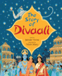 The
Story of Divaali retold by Jatinder Verma, illustrated by Nilesh Mistry
is a wonderful rendition of the "Ramayana," an age-old Hindu epic filled with
magic, miracles and adventure. The compelling story tells of a young prince Rama
who overcomes Ravana the Demon King. Out of his triumph, Divaali, the Indian
festival of lights, is born. The
Story of Divaali retold by Jatinder Verma, illustrated by Nilesh Mistry
is a wonderful rendition of the "Ramayana," an age-old Hindu epic filled with
magic, miracles and adventure. The compelling story tells of a young prince Rama
who overcomes Ravana the Demon King. Out of his triumph, Divaali, the Indian
festival of lights, is born.
The powerful narrative is perfectly complemented by the jewel-like illustrations
of Nilesh Mistry. Drawing on the versions told to him in childhood by his
parents, Jatinder Verma brings the essence of this great Indian epic to life for
a new generation.
Hardcover, 40 pages. Full-color illustrations. Read alone: ages 6-10, Read
together: ages 4-8.
#9360 $16.95 $12.99
|
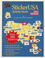 StickerUSA Activity Book
& Bonus CD by Carolyn Hurst uses U.S. outline maps
and stickers to help the user learn state names, capitals, state birds, flags,
flowers and postal abbreviations. The 300+ brightly colored stickers can be used
to �fill-in-the-blanks� on each state activity page. StickerUSA Activity Book
& Bonus CD by Carolyn Hurst uses U.S. outline maps
and stickers to help the user learn state names, capitals, state birds, flags,
flowers and postal abbreviations. The 300+ brightly colored stickers can be used
to �fill-in-the-blanks� on each state activity page.
State cards printed on perforated card stock so they are ready to pull out of
the book are also available. There are fun facts about each state, information
on time zones, regions of the U.S., major mountain ranges, rivers and much more.
The pages in this book are reproducible and extra sets of stickers may be
purchased separately.
Paper, 152 pages. Includes a bonus CD that allows you to print extra sets of
flash cards and activity pages.
#1062X $24.99 $22.99
We also have one copy of an older edition that does not have the bonus CD. We
are selling it for $14.99. Email to see if it is still available. |
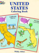
United States Coloring Book (Dover) Includes 50 black and white drawings of all the
states. Captions beneath each illustration identifies the state's motto, flower, bird, tree,
nickname, capital, principal rivers and
mountains.
Paper, 56 pages. 8.25"x11".
#1685 $3.95
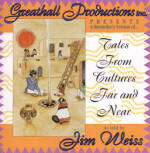 Tales from Cultures
Far and Near (Jim Weiss) - Classic stories from Japan, Spain, China
and more. Wisdom, romance, and humor illustrate our human commonalities. (Have
you ever noticed that "trickster" tales are present in just about every
culture?) Imaginative twists and intrinsic morals bind the tales together.
Length: approximately one hour. Tales from Cultures
Far and Near (Jim Weiss) - Classic stories from Japan, Spain, China
and more. Wisdom, romance, and humor illustrate our human commonalities. (Have
you ever noticed that "trickster" tales are present in just about every
culture?) Imaginative twists and intrinsic morals bind the tales together.
Length: approximately one hour.
Ages 5 to adult.
Cassette: #3088 $10.95 $8.99
CD: #3339 $14.95 $12.99
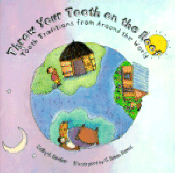 Throw Your Tooth on the Roof: Tooth
Traditions from Around the World by Selby Beeler. When I was little, the
tooth fairy visited my house and left a quarter under my pillow in exchange for
one of my newly "lost" baby teeth. I carried on the same tradition with my own
children without thinking too much about it beyond wondering what to do with
their teeth! Throw Your Tooth on the Roof: Tooth
Traditions from Around the World by Selby Beeler. When I was little, the
tooth fairy visited my house and left a quarter under my pillow in exchange for
one of my newly "lost" baby teeth. I carried on the same tradition with my own
children without thinking too much about it beyond wondering what to do with
their teeth!
So, it was quite interesting to discover that people around the world celebrate
the loss of baby teeth in many different, but also similar, ways. The author
groups the brief descriptions by geographical regions (North America, Central
America & the Caribbean, South America, Africa, the Middle East, Europe, Asia,
Australia & New Zealand), which allows the reader to see some patterns in the
traditions.
Included at the end is a description of the different kinds of teeth we all have
and the parts of the tooth.
Aimed at children ages 4-8, it would also make a great gift for a dentist. Try
pairing it with the tooth pillow below.This is a fun, informative book. Lots
of colorful illustrations. Paper, 32 pages.
#2385 $5.95
|
More Geography Pages
Horrible Geography
top of page |
|

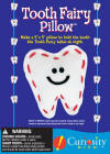 Tooth Fairy Pillow (Curiosity
Kits) This simple craft kit makes a cute little tooth-shaped pillow to hold a
tooth waiting for a Tooth-Fairy pickup. The kit includes everything you need to
make one 5" x 5" felt pillow.
Tooth Fairy Pillow (Curiosity
Kits) This simple craft kit makes a cute little tooth-shaped pillow to hold a
tooth waiting for a Tooth-Fairy pickup. The kit includes everything you need to
make one 5" x 5" felt pillow.